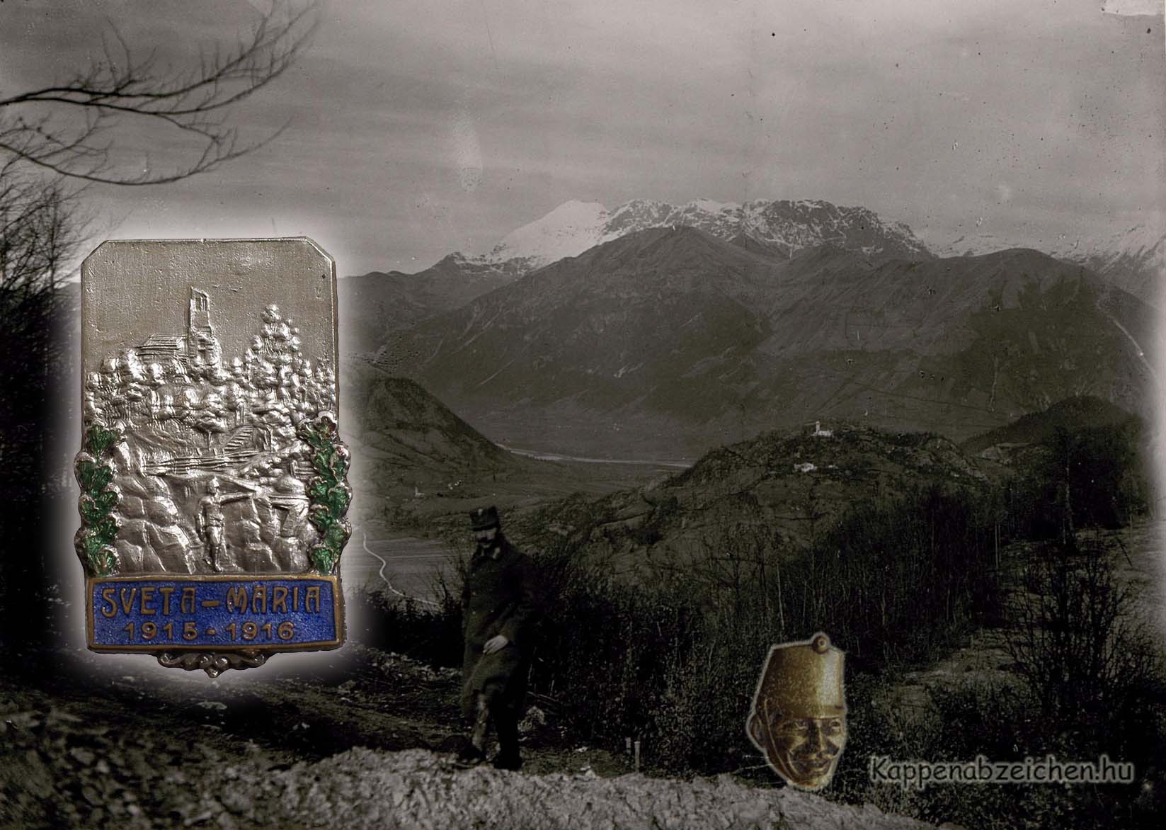
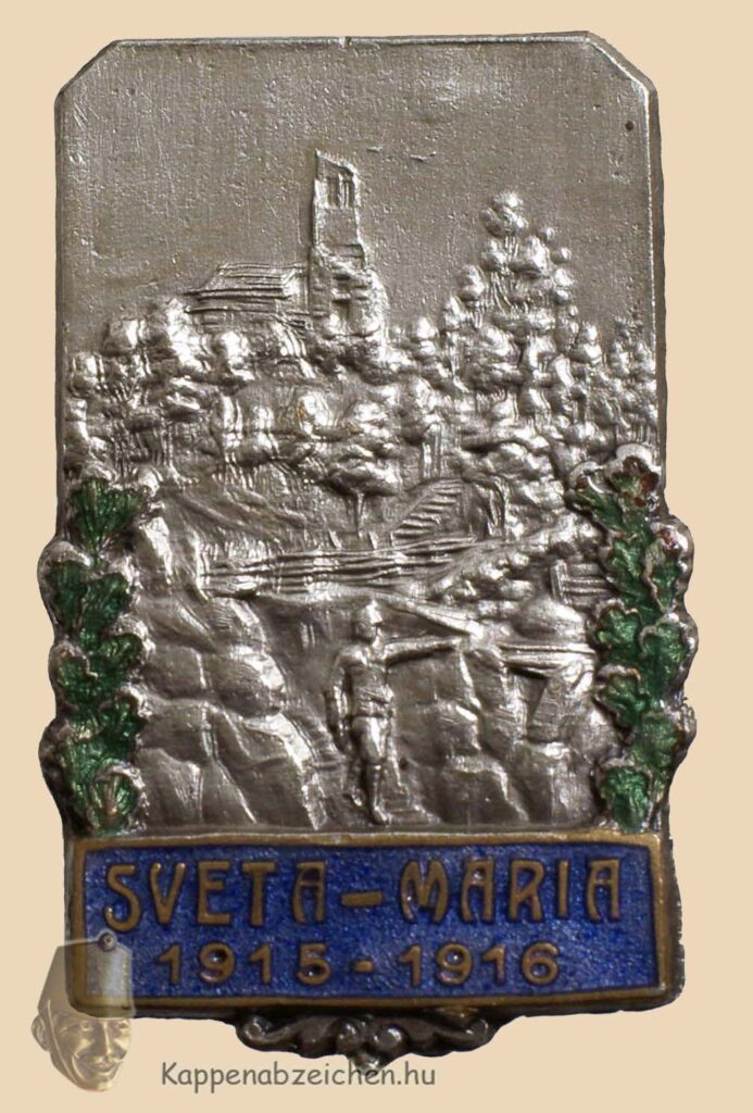
Sveta Maria
It’s been a long time dream of mine to get this fantastically beautiful blue shade enamel badge. When I succeeded, as usual, I wanted to know what was shown on the badge and what the inscription referred to. I was unsuccessful for years. But as the amount of data and knowledge transferred to the cloud increases, even long-abandoned topics can be investigated with better chances. This happened also to the issues of the Sveta Maria badge.
The hilly landscape, the Slovenian-sounding name, has always drawn my attention to the Isonzo front. Back in the paper-based world, I obtained a contemporary, detailed map, which I studied for hours and days, but I could not find the inscription Sveta Maria on it. The wooded hillside mostly referred to the section of the Isonzo between Görz and Tolmein. To the north, the high terrain (Krn) and to the south the flatter Karst did not fit into the picture.
On the Hungarian Great War blog, the name Sveta Maria appeared several times in the reminiscences, but unfortunately the reporters were not in this area of the field, they only mentioned the name, e.g. that the front stretched from there to the ridges near the Isonzo. The search narrowed more and more to the bridgehead around Tolmein. The breakthrough came a few days ago, because I found the picture on the front page on the Internet. According to the inscription, Sveta Maria can be seen in the foreground to the right.
But what is Sveta Maria? The hill or the church on it? There was no such name anywhere on my map, and even though I browsed Google’s various maps, it was not found even among today’s geographical names. Then I turned to the good old paper-based sources again. I tried to find an infantry regiment that fought in the bridgehead. The front section was occupied by the 15th Mountain Brigadein the Summer of 1915. One of its battalions was II/34. Finally, in the history of the 34th regiment, I found the necessary information: starting from the Isonzó bridge, passing by the evacuated Woltschach, the battalion took up a defensive position on the sides of the two heights in the bridgehead.
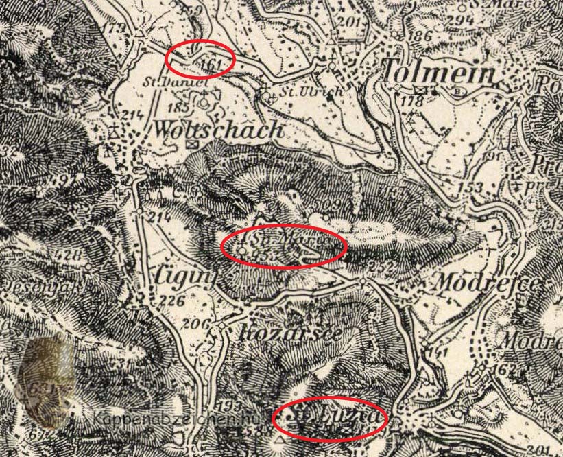
The attached map fragment comes from the volume. Above I have marked the Isonzo bridge, on the lower right you can see the settlement of St Luzia, where there was also a bridge. The Italian positions were on the mountain range bordering the plain to the left. In the middle we see the name Sveta Maria. According to the volume, this signified the small church on the hill, but the whole hill was also named after it.
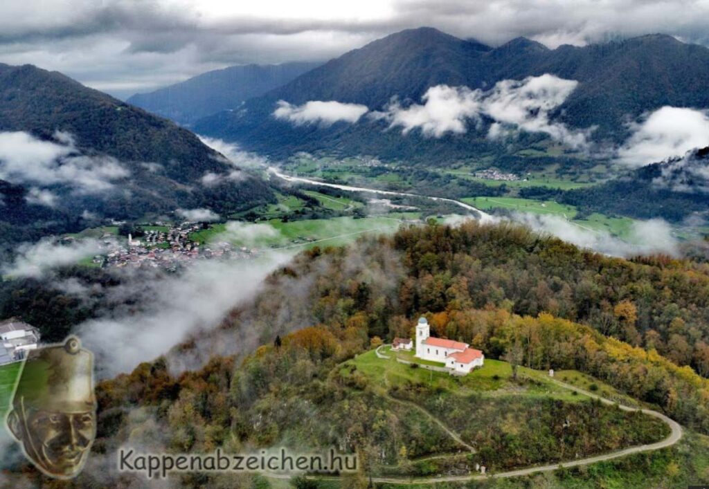
Both the photo and the modern image were taken from the top of the higher mountain further south in the bridgehead. In the northern direction, the Sveta Maria mountain and the church (Sveta Maria na Mengore) can first be seen. Behind it flows the Isonzo, on the other side of which the bigger mountains start: Vodil, the much-besieged Mrzli Vrh, and then the Krn block above the Sleme saddle.
According to the descriptions, there was mainly artillery fire activity against the bridgehead, the large infantry attacks were concentrated around the Krn. The great counterattack of 1917, however, started from the bridgehead