
Col di Lana: the mountain of blood and iron 1.
This post has been written by a good friend Mátyás Boda, thank you Mátyás!
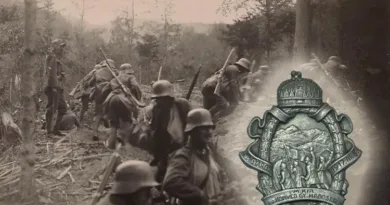
After long hesitation the Italians finally withdrew from the Triple Alliance in the spring of 1915, they entered the war on the side of the Entente in May in accordance with the Treaty of London, against their former allies. By this time, the Monarchy was already engaged on two fronts – the Balkans and Galicia. The Italian nation-state, which had gained independence in previous years, then saw the time had come to carry out its further plans. These were aimed at acquiring the Italian provinces inhabited by Italians in the narrower sense and increasing economic and military influence along the Adriatic coast from Istria through the Balkans to the Mediterranean coast of North Africa. According to Italian calculations, the occupation of the unprotected hinterland belonging to the Monarchy, South Tyrol and Carinthia, as well as the port city of Trieste and the Istrian peninsula served this purpose. However, the line of the planned offensive could not be called ideal. A significant part of it stretched through the eastern mountain ranges of the Alps. At the time, with the opening of the third (south-western) front, in sharp contrast to their preliminary expectations, they engaged long, loss-making and reserve-consuming trench fights in the Alps along the Isonzo River in the Karst plateau for years to come.
The battlefields of the south-western (Italian) front, which opened in 1915, can be divided into three major sections. These are from east to west:
isonzo front
carnivorous front
Tyrolean front
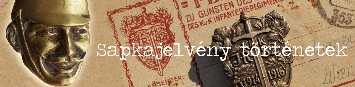
The latter two battlefields are also commonly referred to as the White War, or Glacier Front. These names are not accidental, as their specific environmental characteristics are linked to the high mountain regions. Extreme weather in the realm of snow and frost, in many cases even above the snow line. Unpredictable avalanches, ice walls, life-threatening fissures hidden in the snow, gaping depths, impassable cliffs were characteristic landmarks.
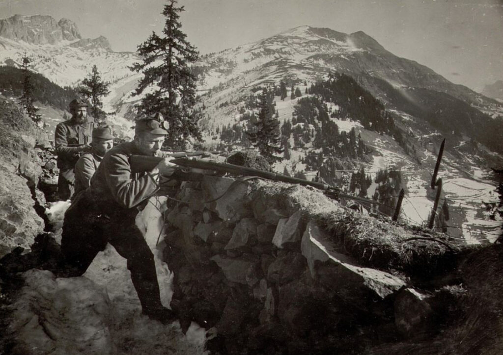
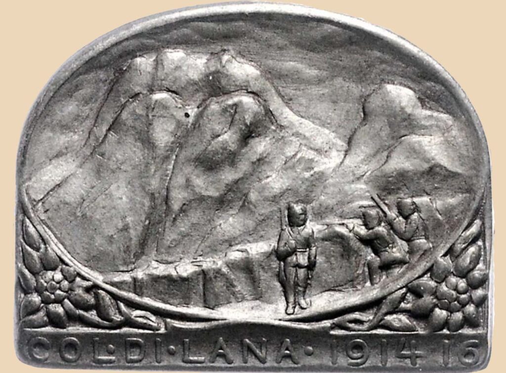
In the early summer of 1915, at the beginning of the offensive, the Italian force planned to advance its way towards the Puster Valley in South Tyrol through one of the characteristic mountain ranges of the Eastern Alps, the Dolomites. To achieve its goal, however, first the Gadertal Valley had to be occupied as an important transport hub. The south-eastern entrance of the latter valley, and at the same time the key dominant point of control over the valley, is the double mountain block, for the possession of which there was a fierce battle between the opponents for months. These fights eventually transformed the double mountain peak itself into the image we see today. This paired peak is called Col di Lana and Mounte Sief.
Italian operations were already at a disadvantage in the early stages of the attack. The general situation of the army was characterized by the fact that it did not have the conditions for a successful offensive warfare at the given time. The achievement of ambitious political goals could not be supported with sufficient economic background or military force. In addition, following the war declaration, Italians lost the power of surprise and the momentum of initiative. They left time for the Monarchy to retreat strategically, to evacuate hard-to-defend areas. Defenders were left with a reserve of strength to improve the fortifications on the heights, and to regroup and replenish their armies and formations. As a result, the attackers were forced to face much more significant artillery preparation in almost all cases before the infantry attacks against the heights, which did not always produce the expected result. The ever-expanding caverns and covers drilled into the rocks could provide the defenders with more secure protection from the snare fire lying on them. If, however, it was possible to overcome, occupy and maintain a high point for a longer period of time, it usually cost a great deal of blood loss and waste of ammunition. The Italians were stronger, although, as events later proved, their military leadership was unable to forge the resulting advantage into a series of decisive victories on the battlefield.
However, the situation of the defenders was not cloudless either! Unlike the Italians, the Monarchy had been at war for almost a year. Its resources were tied up by two fronts and constantly dwindled. This was now joined by another, third front with its own mountainous conditions, where the acquisition, protection and supply of every meter consumed multiple energy reserves. Both armies were familiar with the fighting style adapted to the alpine environment, as the peoples living here adapted their daily lives as well as their military training to the environmental conditions. In the years following the birth of the united Italy, both sides built a series of artillery fortifications in the Dolomites along their common borders. All special troops were represented, although naturally this did not mean that they were the only ones to fight in this so unusual environment. Although it was able to redeploy forces from the Serbian front of the Monarchy to its new battlefield, there were not enough special mountain formations available.
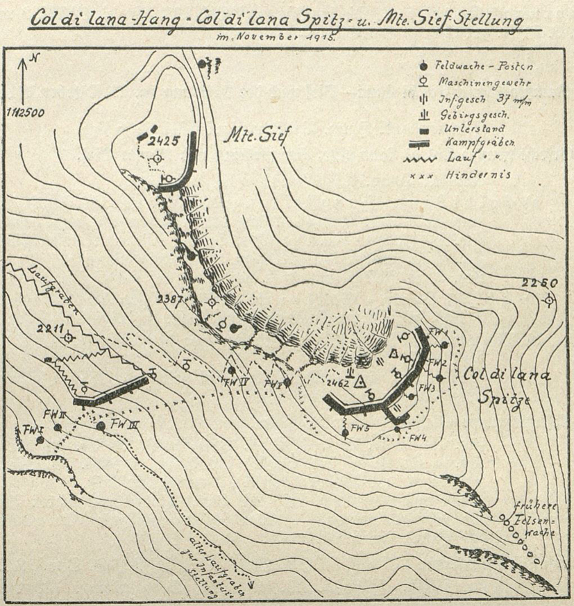
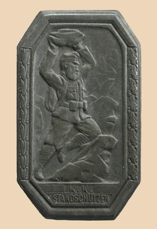
Tyrolean Landsturm and the so called shooters’ battalions (k.k. Standschützen-Battalion) supplemented the Tyrolean hunter regiments (Tiroler Jager-Regiment) and the Landwehr mountain troops (incl. Landwehrgebirgs-truppen). The Italians were still ahead of them, backed by well-trained “Alpini” and mountain-trained “Bersaglieri” troops. In addition to all this, the Monarchy needed the help of its German ally, as many Tyrolean and Carinthian units fought or bled on battlefields outside their narrower vicinity. The German emperor sent hunting regiments of the Alpine Corps of the Bavarian federal state (Deutsche Alpenkorps) to the area, with the firm order that they could act only defensively, maintaining the status quo in the territory of the Monarchy alongside their ally. They cannot launch offensive movements against Italy, their former ally.
Following such antecedents, the first combat contacts took place around the Col di Lana in the summer of 1915. The location of the elevation and the terrain were favorable for the defenders. The two peaks, which magnify as a large array over its surroundings, are part of a smaller group. Going southeast, they are:
Panettone (2125 m)
Cappello di Napoleone (“Napoleon’s Hat”, 2200 m)
Col di Lana (2464 m)
Monte Sief (2424 m)
Col de la Roda (1971)
Their sloping sides change into steep, non-climbing rock walls in many places, while they are relatively easier to walk elsewhere. The two peaks (Col di Lana and Mte. Sief) are connected by a narrow ridge, which in several places is only one person wide. Up to the top, a multi-stage, fortified defense system had to be overcome with a frontal attack. The undulating fierceness of the ensuing fighting is reflected in the fact that more than thirty attacks were launched against the infantry positions at the waist of the mountain, the Cappello di Napoleone, by mid-October. Then the Italian brigade “Calabria” under the command of Giuseppe Raimondo “Peppino” Garibaldi could take the trenches there. It was only after the occupation of these positions, connected by trenches, that a gradual approach to the peak could follow, the seizure of which also initially failed.
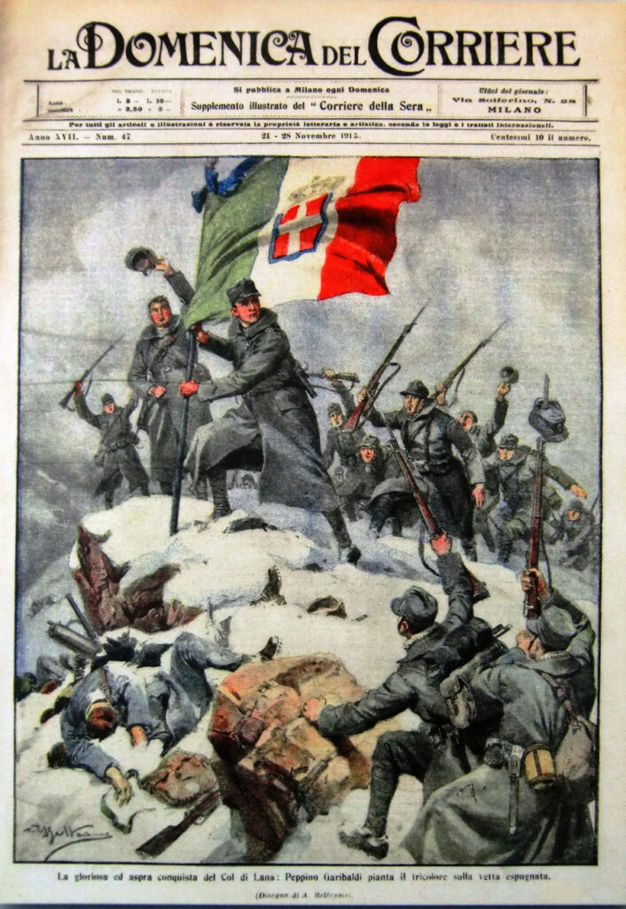
On November 7, 1915, the Italian Viterbo 60 / III. infantry battalion finally managed to expel the defenders from their main positions with an attack launched near the mountain saddle. Their own flag was finally hoisted on the Col di Lana summit in the late afternoon, and later Garibaldi was appointed extraordinary colonel for this action. However, the faint rays of the autumn sun lurking behind the mountains did not have enough time to make a longer acquaintance with Italy’s tricolor, as the counterattack, which started with artillery support at ten o’clock in the evening, threw the afternoon winners out of their newly occupied positions. Till the end of the year, there were several more attacks bleeding near the peak, while the sons of Cadorna were only 50 m away, 50 m certain death separated them from the roof!
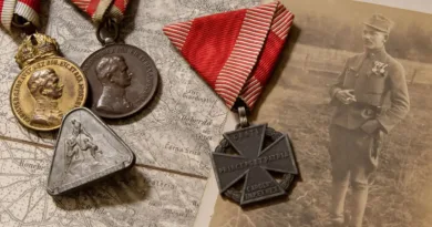
Meanwhile, as usual, legends came to life. The Italians began to call this special place of their sacrifice Col Sangue, “Blood Hill”. In response to this, the German-speaking bucks of the Imperial Alliance christened the place Eisenberg, or “Iron Mountain,” referring to the insatiable amount of artillery projectiles that turned the forts and rocks almost iron.
At the beginning of the year 1916, the besiegers finally realized that the abundance of effort and human sacrifice had all proved futile. Over the course of half a year, the picturesque romance of the alpine environment gave way to the apocalyptic sight of war destruction. The number of fallen soldiers left behind during the retreats, the multitude of shattered, fallen trees, the innumerable rows of craters pierced the mountain, and the day-to-day multiplication of wooden crosses in heroic cemeteries testified to all the human mortality that this mountain possessed. After the brief seizure of the peak in early November, the weather became more and more unfriendly. The further onslaught against the summit lost its meaning as the harsh winter set in. However, the attackers did not back down, so they had to change tactics. Soon was the bold plan born to undermine and blow up the Austrian headquarters. The concept may seem familiar, since as early as October 1915, the Italian opponents used the same method on an experimental basis to overcome positions on the Karst Plateau. By the spring of the following year, this kind of fighting style was already known in the practice of both parties, which Archduke Joseph aptly christened a “mock war” in his diary entries. This practice was carried over by the Italians in the spring of 1916 in the Dolomites, against the peaks of the col di Lana, which proved impractical.
TBC…
[…] Dolomites are located on the eastern border of Tyrol. An earlier post could already be read about the battles taking place here. The Italian attack got stuck at the foot […]
[…] called “the mountain of blood”. There was already a post about the operations here (this), now I would like to present a recently found drawing that illustrates the mine warfare on the […]